In the webinar, “Monarch Butterfly Biology, Ecology and Conservation Needs,” Fisher will highlight the outcomes of collaborative work on monarch butterfly conservation conducted at Iowa State University, including the notable suggestion that milkweed and nectar resources be planted within 50 meters of established habitat to create a functionally connected landscape that facilitates monarch movement.
Continue readingProject AWARE 2017

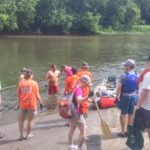
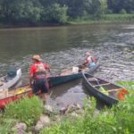
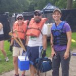
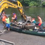
- Photo of Cedar River Coalition partners. Photo from @IWAReduceFloods, the Twitter account for the Iowa Watershed Approach.
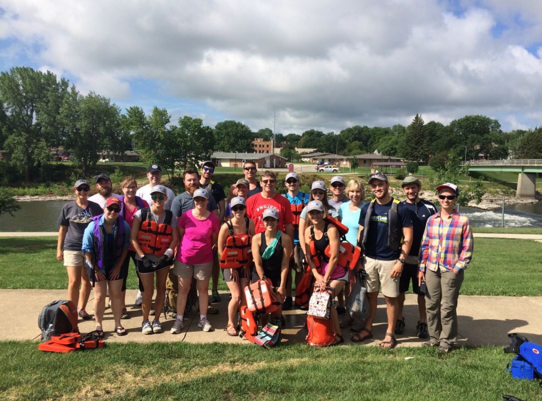
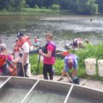
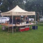
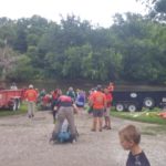
Getting Down and Dirty for Cleaner Iowa Rivers
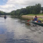
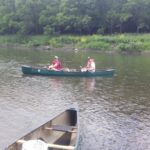
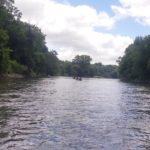
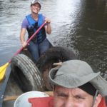
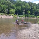
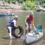
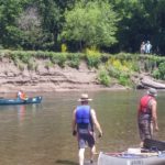
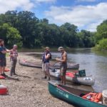
Last week we participated in cleaning up an Iowa river alongside the Iowa Department of Natural Resources and other water partners across the state for Project AWARE. This event is a week-long outdoor expedition to clean up a selected Iowa river. The purpose of this event is to increase awareness of and engagement with Iowa’s public waters. It gives Iowans the opportunity to make a difference in water no matter who they are and what they do in the state. Participants have the opportunity to do the cleanup for one day or stay and camp the whole week.
This year, the event was held on the Cedar River in Mitchell and Floyd Counties from July 10-14. Hundreds of water partners and community members across the state joined for this year’s cleanup. We attended the fourth day of the event. Our starting point was about 19 miles up river from Charles City, Iowa. Once we arrived in Charles City, we had the opportunity to go inner tubing down the Charles City Whitewater course to the campsite to receive a t-shirt and join in on evening fun at the site.
While we only attended one day of the trip, we found many canoe-loads of trash that does not belong in a river, such as barrels, tires, and even a couch!
See photos below for the highlights!
Soil – Agriculture’s Reservoir

Post submitted by Hanna Bates, Program Assistant for the Iowa Water Center
The soil is like a sponge that holds water so it is available when crops need it. Wetter soil at the surface prevents deeper infiltration and so water is lost as surface runoff. Not only this, but soil moisture is also a variable that influences the timing and amount of precipitation in a given area. This is due to the impact it has on the water cycle. This cycle circulates moisture from the ground through evaporation and plant transpiration to the atmosphere and back to the ground again through precipitation. Therefore, the amount of water stored in the soil can affect the amount of precipitation received during the growing season.
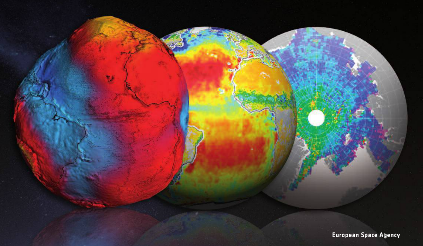
According to Hornbuckle (2014), “we enter each growing season ‘blind’ as to whether or not there will be enough soil moisture and precipitation to support productive crops.” If there were a way to document and record water storage in the soil besides field measurements, we would have a better ability to predict future weather patterns and therefore, make better field decisions. Satellite remote sensing tools such as the European Space Agency’s Soil Moisture and Ocean Salinity (SMOS) and NASA’s Moisture Active Passive (SMAP) can be used to take such measurements. Before these tools can be used to estimate water storage and improve weather and climate predictions, researchers must compare them to what is actually measured within the soil. This process of confirming accuracy of a tool is called validation.
A project led by Dr. Brian Hornbuckle, and funded by the Iowa Water Center in 2014, sought to improve and validate SMOS and SMAP in near-surface soil moisture observations of Iowa. Hornbuckle used a network of soil moisture measurements located in the South Fork Watershed as a standard to validate the accuracy of SMOS and SMAP. At each site, soil moisture and precipitation was measured.
Some of the results of this research project are presented in a 2015 article published in the Journal of Hydrometeorology. Rondinelli et al. found that SMOS and the network of soil moisture measurements detect different layers of the soil. SMOS takes measurements of the soil surface while the network observes a deeper level of soil. These results will allow scientists to better evaluate the accuracy of measurements from SMOS and SMAP and ultimately enhance our understanding of the water content of the soil surface. As noted earlier, it is this layer of the soil that determines how much precipitation is lost to surface runoff.
In a subsequent study published in 2016, Hornbuckle et al. published further results that indicate new ways of using SMOS. Researchers found that SMOS can be used to look at water in vegetation, as opposed to water in the soil. Hence SMOS might be used in the future to observe the growth and development of crops, and perhaps estimate yield and the time of harvest as opposed to conducting field surveys from the ground. It also has the potential to measure estimates of the biomass produced during the growing season, which could be useful to reach bioenergy production goals.
Research like this demonstrates that a single tool can be used in multiple ways to better understand our landscape. Not only this, but preliminary studies of SMOS also show that it is important to verify the accuracy of tools before relying on them. Like all research, the work is not done to identify all the potential uses for SMOS and SMAP. A new NASA grant, in partnership with the Iowa Flood Center, will help get researchers even closer to making satellite measurements a useful, scientific tool to understand water near the soil surface.
References
Hornbuckle, Brian K. “New Satellites for Soil Moisture: Good for Iowans!.” A Letter from the Soil & Water Conservation Club President (2014): 20.
Hornbuckle, Brian K. Jason C. Patton, Andy VanLoocke, Andrew E. Suyker, Matthew C. Roby, Victoria A. Walker, Eswar R Iyer, Daryl E. Herzmann, and Erik A. Endacott. 2016. SMOS optical thickness changes in response to the growth and development of crops, crop management, and weather. Remote Sensing Environment (180) 320-333.
Rondinelli, Wesley J., Brian K. Hornbuckle, Jason C. Patton, Michael H. Cosh, Victoria A. Walker, Benjamin D. Carr, Sally D. Logsdon. 2015. Different Rates of Soil Drying after Rainfall Are Observed by the SMOS Satellite and the South Fork in situ Soil Moisture Network. Journal of Hydrometeorology. April 2015.
Cedar River (essay)

In honor of publishing the 2017 Spirit of the Water Essay Contest, the Iowa Water Center staff have decided to join in and answer the chosen essay prompt for the contest.
This year, the prompt was: Think of a body of water that you are familiar with and the different kinds of benefits that it provides to the surrounding area. Why are places like that worth protecting?
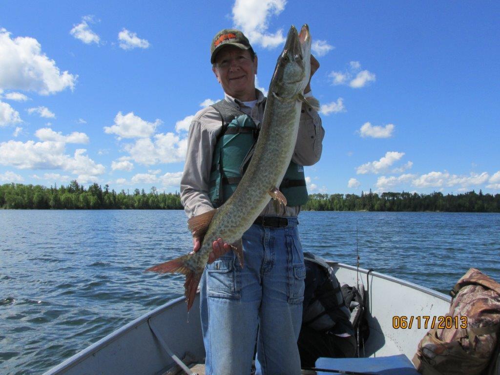
Dr. Richard Cruse fishing in 2013. Photo submitted by Cruse.
Cedar River
Story submitted by Dr. Richard Cruse, Director of the Iowa Water Center
What is it that makes lakes and streams so special to so many? Is it what our eyes see, or what our noses sense, or maybe it is the sounds associated with diverse life along these bodies of water? Maybe it is the sense of warm or maybe chilly water as you walk in a stream or the temperature of a fish you hold taken from the water. And what about the personal feelings of freedom that comes from bonding with constantly flowing water as it finds it way around the next bend? And then there is the mystery of what lies beneath the surface, a surface that reflects your image like a mirror no one can ever possess.
My personal bond with streams was first tied to fishing in the Cedar River. I spent countless hours sitting on the bank with a fishing pole in hand, dominantly early in the morning or late at night pursuing what was then our sport fish – the channel cat. As I learned what worked (and of course what did not), success was the norm. Catching was not the challenge it once was, nor was it as exciting as it previously had been because I had experienced it many times. Yet, my drive to repeat the fishing activity grew. What was truly driving my urge to fight mosquitos and suffer welts from an occasional poison ivy or nettles encounter? It was not the thrill of catching a fish, the likes of which I had caught many times before. It was, and still is, the bond and sense of freedom that comes from a natural water connection.
My sense of connectedness with the natural world has grown from the seeds planted in my childhood along the Cedar River. I’ve fished for REAL sportfish in what some consider quite glamorous fishing locations – Minnesota, Ontario, and even in Europe. I’ve camped along lakes in the Canadian Wilderness about which many can only dream. I’ve camped and hunted in the Saw Tooth Mountains of the Idaho Rockies following, crossing and drinking from mountain streams overflowing with energy, freedom, and the laughter of Mom Nature. My desire to return to these locations is immense, but no greater than the desire to return to the sand bars on which I camped as a teenage on the Cedar in Bremer County.
The passion of those that have experienced the unexplainable connection with our lakes and streams drives our desire to maintain or improve water quality and natural resources in Iowa and the nation. The magic of the water moments cannot be duplicated or reproduced with any technology known to man. My dad told me often, not everything with value can be bought, and in fact, things with the most value have no price tag. My bond with the natural world is priceless and my desire to share these experiences with family and friends knows no bounds. May everyone sometime experience the choir of frogs singing relentlessly through the night, the echo of rippling water flowing across a rocky river bottom, the fragrance of fresh air heavy with night time dew, and the unexplainable joy that only these experiences can bring.
Daily Erosion Project goes International
This week Dr. Richard Cruse, Professor in Agronomy at Iowa State University and Director of the Iowa Water Center, was invited to speak at the Rendez-vous végétal 2017 in Quebec, Canada. He provided a presentation on the cost of soil erosion and introduced the Daily Erosion Project to an international audience of soil and water professionals.
Continue readingPodcast spotlights a pioneer of precision conservation
Precision agriculture is a unique, emerging field, and it is certainly one that is rapidly evolving before our very eyes. The complex world of remote sensing, big data, ag informatics, statistics, and on-the-ground farm management means there’s a whole lot of data out there … how do we make sense of it all?
Continue readingGeographic Information Systems at Iowa State University
Big data requires big software and big ideas. This can be especially true when it comes to managing our water-related resources. Today, we have access to numerous data points about our soil and water that can assist in understanding current landscape conditions and to plan for the future. Information such as this is not useful unless it can be analyzed by the experts using software such as Geographic Information Systems (GIS).
Continue readingMonona Demonstrates its Commitment to Water Quality
The permeable parking lot carried a price tag of about $260,000.00. The project would not have been possible without the Water Resource Restoration (Sponsored Projects) Program. The Sponsored Project program allowed Monona to defer a portion of the interest on its sewer project loan, and use those funds for watershed protection practices. The program is a joint effort of the Iowa Department of Natural Resources, the Iowa Finance Authority, and the Iowa Department of Agriculture and Land Stewardship. The permeable roadway project was also supported by the Sponsored Projects program.
Continue readingFarmers are Covering Iowa
The Iowa Seed Corn Cover Crops Initiative is a new Iowa Department of Agriculture and Land Stewardship Water Quality Initiative project that will run through 2018. This project is through the Iowa Seed Association in collaboration with the Agribusiness Association of Iowa, the Iowa Farm Bureau Federation, Iowa Corn Growers Association, and the Soil and Water Conservation Society.
Continue readingGet to know the Prairie STRIPS Project
Two weeks ago, the Iowa Water Center staff attended a lecture on a study conducted with the Iowa State University Prairie STRIPS Project. Eduardo Luquin Oroz, graduate student at the University of Wageningen, presented results from examining the sediment deposition at the sites associated with this project as well as the strip width effects on sediment deposition. After leaving the presentation, the above quote immediately entered my mind.
Continue reading