Iowa Learning Farms, in partnership with Consortium for Cultivating Human And Naturally reGenerative Enterprises (C-CHANGE), will host a cover crop workshop on Tuesday, February 14, noon-2:00 p.m. at the Sioux County Extension Office.
Continue readingBuilding Youth Leadership Capacity Through Project-Based Learning
“ The world needs people who can lead others to make a change for the better if anything is gonna change for the better.”
This is a reflection from a Davenport North High School junior, one of the first students to experience environmental science education through a pilot program called “The Watershed Project,” sponsored by the Leopold Center for Sustainable Agriculture and administered by the Iowa Water Center (IWC).
Continue readingAsk a Scientist – Flood Modeling
[youtube https://www.youtube.com/watch?v=GY6a9qEkrso]
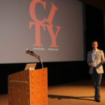
Iowa Water Center City Spotlight: Des Moines
By Joe Otto, Communications Specialist at the Iowa Water Center
The City Spotlight series highlights ongoing efforts by Iowans living in cities to address water issues impacting their neighborhoods.
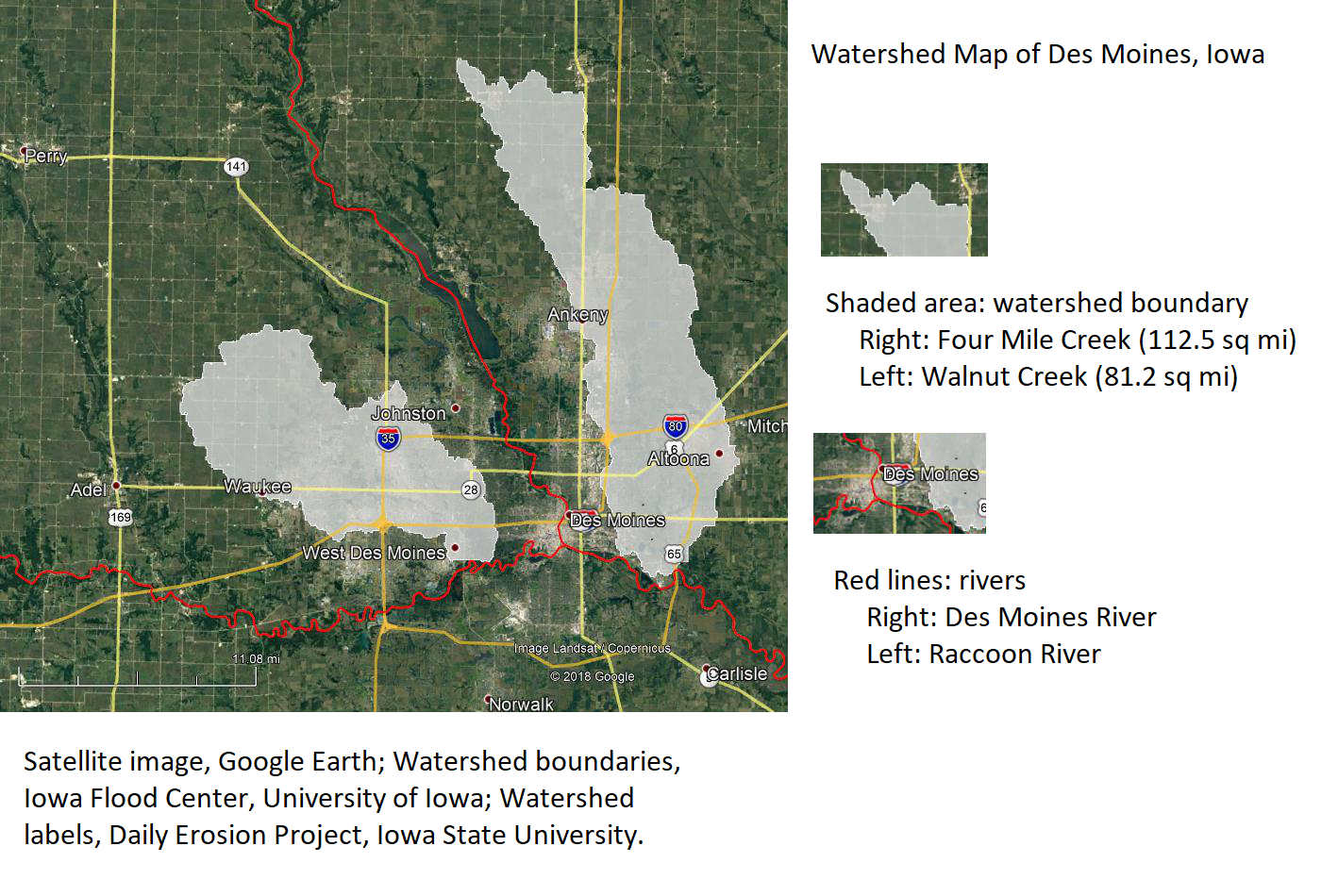
Des Moines residents and officials working on watershed approach
The City of Des Moines is taking steps to improve emergency planning ahead of major flood events. In response to damaging floods in 2018, city officials formed a Flash Flood Committee to identify and study various flood-related emergency issues. The report was released in January of 2019 and can be viewed on the city’s website.
The flood event that triggered the report came in late June, when torrential rains fell across parts of the Raccoon and Des Moines River valleys upstream from the city. The National Weather Service issued a flash flood warning at 9:30pm on the night of June 30th. Over the next 24 hours Des Moines police dispatch answered nearly 1,700 calls and the fire department responded to over 150 calls for rescue or assistance. This heavy demand for services challenged the city’s public safety officials who in the report recommended more coordination across city departments and the possibility of issuing preemptive evacuation orders.
In addition to public safety, the report identified five areas where city officials and residents can better prepare themselves: communications before and during a flood, debris management and cleanup afterward, storm water infrastructure and capacity, insurance availability, and sustainable development and planning to lessen the damage of future floods.
From a communications standpoint the report recommends the creation of an emergency response plan that would be reviewed annually and spreading awareness through education and outreach during a “severe weather awareness week.” Other recommendations included the creation of an emergency communications website operated jointly by Polk County and the City of Des Moines, and encouraging neighborhood associations, residents, and businesses to form their own flood response plans.
The June floods generated over five million pounds of debris, which created logistical problems for public works and waste management officials. From a debris management standpoint, the report recommends establishing clear rules on curbside pickup of debris in the wake of a flood emergency, using GIS technology to map the most efficient routing for truck drivers picking up debris, designating areas in the city as debris drop-off sites, and distributing “bagster”-style cleanup bags to effected residents.
From an infrastructure standpoint, the report recommends changes to the city’s building permitting that would require new construction projects to meet environmental and stormwater mitigation standards that would be set by the City. Home and business owners are further encouraged to build their own stormwater management systems that include rain collection barrels, water gardens, and more grass cover. Public infrastructure is to be assessed for its capacity and augmented or replaced if needed. Costs to cover these changes would come from a 1% sales tax increase and a plan to set aside a higher percentage of property taxes and devote them to stormwater projects.
From an insurance standpoint the report recommends the city take steps to improve its Community Rating Score (CRS). Determined by FEMA, a city’s CRS is a valuation of how much effort it puts into flood protection and flood planning beyond the minimum standards set forth in the National Flood Insurance Program. Cities that exceed minimum standards are rewarded with lower scores, and consequently lower flood insurance rates. Des Moines currently has a CRS of 7, which translates to a 15% discount on federal flood insurance. The City of Cedar Falls, by comparison, has a CRS of 5 and qualifies for a 25% discount. Achieving a lower CRS score requires extensive, long-term planning of projects such as those outlined in the 2018 Flash Flood Report.
From a sustainability standpoint the report recommends a watershed approach to flood control and emergency planning. Such an approach would require public and private support from beyond the city limits of Des Moines, particularly among upstream communities. Possible routes of cooperation might include upstream communities participating in the FEMA CRS program, which qualifies them for federal funding for floodplain management planning. Of the six Iowa cities participating in the CRS program, the only city in the Des Moines/Racoon River watershed is Des Moines. Four are in the Iowa/Cedar watershed and one is along the Mississippi River. FEMA also allows counties to participate, of which there are three in Iowa that do: Linn, Story, and Pottawattamie; with Story being the only county that shares part of a watershed with the City of Des Moines.
Finding neighboring cities and counties in the watershed would go a long way towards better flood planning and preparedness during emergencies, which is the goal of a community group that contributed to the Flood Report. The sustainability portion of the Flood Report was written in consultation with the Des Moines Citizens Task Force for Sustainability. Established by the Office of the Des Moines City Manager, the Task Force was created as part of the city’s long-term strategic plan. The Task Force’s community contact, Carolyn Ulenhake Walker, would like to see more city resources devoted to long-term planning and flood resilience. When asked how she thought the city officials could move the needle on these issues, Ulenhake Walker recommended more attention be given to watershed planning; “Because we know extreme rain events are occurring more often, the taskforce thinks watershed projects need more attention and more money.” She was also supportive of looking for like-minded stakeholders outside of the city limits. The metro-adjacent cities of Ankeny and Clive are collaborating with Des Moines on watershed planning projects for the Walnut Creek and Four Mile Creek watersheds. Additional support is being provided by officials with Polk County’s Soil and Water Conservation office in Ankeny. Although these projects are still in the developmental stages, Ulenhake Walker is optimistic the watershed approach will be successful; “[We] would like city staff to really research this topic, as well as act upon the [watersheds approach] recommendation.”
The author of the Flood Committee’s sustainability recommendations echoed the Task Force’s plea. Brian Campbell, Director of Sustainability Education at Simpson College, says that 2018 Flash Flood Report is an opportunity for the City of Des Moines to situate itself in broader conversations about sustainability and watershed planning; “Our hope would be that city leaders work to engage as broadly as possible – upstream and downstream, inside and outside Polk County.” Although a planning process involving multiple stakeholders can be painstakingly slow, Campbell is optimistic that the city can make quick progress by adopting models already in use elsewhere; “I’m not an expert in this area, but my sense is that something like the Iowa Watershed Approach (IWA) would be helpful to convene different stakeholders.” Both Campbell and Ulenhake Walker attended a fall 2018 meeting about the benefits of the IWA and incorporated their findings into the recommendations. The meeting was hosted by Des Moines-based engineering company RDG Design.
While the planning process slowly moves forward, the city has also taken short-term action. Homes in the areas hardest-hit by the June floods are being bought by the city. As of the end of 2018 the city has acquired 78 properties at a total cost of $10.5 million. Most of the properties lie along Four Mile Creek, on the city’s northeast side.
Residents interested in a watershed approach for Des Moines are encouraged to attend any regular meeting of the Citizen’s Taskforce on Sustainability. The group meets monthly, on the first and third Wednesdays, at 4:30pm. The meeting location is Ingersoll Park, at 4906 Ingersoll Ave. For more information contact Carolyn Ulenhake Walker at carolynruw@gmail.com.
 Joe Otto is the Communications Specialist for the Iowa Water Center. He is a doctoral candidate at the University of Oklahoma, where he is writing a dissertation on the history of drainage in Iowa.
Do you live in a city facing a pressing water management issue? Let the Iowa Water Center put a spotlight on it. Contact jwotto@iastate.edu for more information.
Works Cited
“2018 Flash Flood Report,” Des Moines City Council Workshop Reports. Accessed 1-9-2019. http://www.dmgov.org/Government/CityCouncil/WorkshopDocuments/20190107%20Flood%20Activity%20Report.pdf
Campbell, Brian. Director of Sustainability Education, Simpson College, personal communication, January 16, 2019.
City Manager, Office of. “Sustainability Efforts.” City of Des Moines. Accessed January 24, 2019. https://www.dmgov.org/Departments/CityManager/Pages/SustainabilityEfforts.aspx
Daily Erosion Project. Iowa State University. Accessed January 24, 2019. https://dailyerosion.org/map/#20190124//qc_precip/-94.50/42.10/6//0/
Federal Emergency Management Agency (FEMA).“October 2017 NFIP Flood Insurance Manual, 20 CRS Section” FEMA.gov. Accessed 1-9-2019. https://www.fema.gov/media-library-data/1503240360683-30b35cc754f462fe2c15d857519a71ec/20_crs_508_oct2017.pdf
Iowa Watershed Approach, Accessed January 24, 2019. https://www.iowawatershedapproach.org/
Iowa Flood Information System. Iowa Flood Center, University of Iowa. Accessed January 24, 2019. http://ifis.iowafloodcenter.org/ifis/en/app/
Ulenhake Walker, Carolyn. Community Contact for Des Moines Citizens Task Force for Sustainability, personal communication, January 15, 2019.
U.S. News and World Report. “Des Moines Spends $10.5M to Buy 78 Flood-Damaged Homes.” Accessed January 15, 2019. https://www.usnews.com/news/best-states/iowa/articles/2019-01-11/des-moines-spends-105m-to-buy-78-flood-damaged-homes
What is the Iowa 4R Plus Program?
by Greg Wandrey, Iowa agriculture program director, The Nature Conservancy and 4R Plus program coordinator
The 4R Plus program is a science-based framework designed to increase awareness and provide information about 4R nutrient stewardship and conservation practices to crop advisers and farmers. These 4R Plus practices can improve soil health, crop yields and water quality.
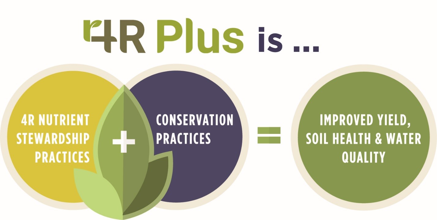
4R Plus combines the 4Rs of nutrient stewardship – applying the right source of fertilizer at the right rate and right time and in the right place – with the “Plus” conservation practices like cover crops, no-till and edge of field practices like saturated buffers and bioreactors. These combined practices are needed to achieve the nitrogen and phosphorus loss goals of the Iowa Nutrient Reduction Strategy. This strategy calls for a 45% reduction in total nitrogen and phosphorus loads going into Iowa waters, with 41% and 29% reductions in nitrogen and phosphorus loads, respectively, from non-point sources, such as agricultural production.
The 4R Plus program began in 2016 by bringing diverse organizations together to create an outreach campaign to help inform Iowa farmers about the suite of conservation practices available to them. To date, more than 40 organizations have enlisted their support of the Iowa 4R Plus program, including agri-businesses, commodity groups, trade associations, government agencies, conservation organizations, Iowa State University and Iowa Learning Farms.
To kick off the project, market research was conducted with Iowa farmers and Certified Crop Advisers (CCAs) to help understand what practices they were using, key messages that resonated with them, barriers that hindered them from trying new practices and what their plans were for adopting new practices in the future. The results showed that messages that resonated the strongest with farmers centered on 1) the role of healthy soil in addressing more extreme precipitation patterns, and 2) the importance of passing the farm to the next generation in better shape than they received it. The market research also verified the importance of CCAs as the trusted adviser to farmers.
With the market research results in hand, 4R Plus coalition members developed 4R Plus informational resources that they could leverage with their internal and external stakeholders, including CCAs and farmers. The resources include a 4R Plus brochure, 4R Plus Fact Sheet, a website (4rplus.org/), 4R Plus Blogs, an adviser module and a Twitter account (@4RPlus). Most recently, a series of five videos were released that describe Conservation Practices, the 4Rs of Nutrient Stewardship and the Iowa Nutrient Reduction Strategy. In addition, the five videos were converted into courses for CCAs to take for Continuing Education Units (i.e. credits). The CCA courses can be found at 4R Plus CCA Courses.
In addition to the 4R Plus resources mentioned above, the 4R Plus program has a communications and outreach component at the state level that includes radio, print and digital media. In 2018, these media platforms are delivering 4R Plus messages to 85-90% of Iowa farmers.
The 4R Plus program is an exciting new effort to bring information about nutrient management and conservation practices to the Iowa farming community in a straight-forward and factual way. The partners are committed to helping farmers implement practices that fit their unique individual operations and provide economic, agronomic, environmental and societal benefits on their farm and to their downstream neighbors.
If you are interested in learning more about 4R Plus or want to join the coalition of more than 40 agricultural and conservation organizations that support 4R Plus, please contact me at gregory.wandrey@tnc.org.
 Greg is a native Iowan who grew up on a crop and livestock near Dyersville, Iowa. He received his B.S. and M.S. degrees in agronomy from Iowa State University and Ph.D. in agronomy and plant genetics from the University of Minnesota. Greg joined the Iowa chapter of The Nature Conservancy in 2016 to lead the Iowa 4R Plus program.
Establishing a Culture of Conservation with Prairie STRIPS
Written by Hanna Bates, Program Coordinator for the Iowa Water Center
Across the Midwest, farm fields are patterned with commodity crops, including corn and soybeans. Although supportive of our global economy, this agricultural system is a leaky one with shallow roots systems in the field that leaches nutrients and depletes the soil. In Iowa’s history, landscapes were previously protected in a blanket of prairie that would build deep roots and replenish the soil. Commodity production and conservation are not necessarily mutually exclusive choices, but an integrative system that farmers can establish on their farms.
Prairie STRIPS is a process in which farmers plant approximately 10% of prairie on the contour while growing their regular rotation in the rest of the field. Over the last 8 months, I have been working with a farmer in Hardin County to establish STRIPS on his 128-acre farm field. Planning STRIPS is an iterative process between the conservation planner and the farmer so that it fits his/her needs. In what I have learned in putting in prairie STRIPS, there is nothing cookie-cutter about the process. Rather, it is one that requires visits to the field and detailed conversations so that the farmer can reach the goals s/he sets for the land.
Visiting the field
Before we can start putting a plan on paper, it is important to go out and walk the field with the farmer to see what the topography is like and how the drainage flows through the field. In walking through this field, I saw that the farmer had grassed waterways already established. Despite having a few practices like this in place already, there were a few spots in the field that were experiencing a wash out every growing season and were financial losses. These happen to be primary spots where Prairie STRIPS could be placed. When this was noted to the farmer, he was excited for the possibilities of how his field could perform in yields by saving these spots and preventing problems, such as soil deposits and increased drainage velocity for the areas below the washout spots in his field.
Making the plan
After visiting the field, the next step is to work in ArcMap to sketch out where the potential STRIPS can be placed. Using a series of maps and knowing the future rotations plans in the field aids in this decision-making process. These aren’t necessarily viewed as limitations, but rather as narrowing the scope and providing direction to planning in ArcMap. We started with integrating the contoured STRIPS with the grassed waterways as well as adding blocked STRIPS at the south end of the field. We presented the plan to the farmer and the few edits we had to make to the plan were to square off where the Prairie STRIPS meet the grassed waterways for ease of mobility for his equipment. All strips were placed at intervals that are divisible by 30-feet to accommodate equipment and create uniform farming lanes. Prairie species included in the STRIPS is a mix of grasses and forbs (see Table 1 below). Maintenance will require routine mowing.
Identifying future needs
The Prairie STRIPS are currently in the first year of growth as they were planted in late Spring 2018. The first several years require some maintenance with mowing, but as the species grow and mature over time, they will require less maintenance. As these plants mature, they will provide a wildlife habitat and serve as a corridor for migrating birds. The STRIPS will provide ecosystem benefits as well as serve the community up in Hardin County by being a model for conservation and set an example for others in respect to what good farming is.
In Summer 2019, we will hold a Prairie STRIPS field day on the farm. Be sure to sign up for our newsletter to receive the details!
| Table 1. Prairie STRIPS Prairie Species | |
| Grasses | Forbs |
| Big Bluestem | Anise Hyssop |
| Sideoats Grama | Common Milkweed |
| Prairie Brome | Smooth Blue Aster |
| Canada Wild Rye | New England Aster |
| Switchgrass | Canada Milk Vetch |
| Little Bluestem | White Wild Indigo |
| Indiangrass | Partridge Pea |
| Prairie Dropseed | Tall Coreopsis |
| White Prairie Clover | |
| Purple Prairie Clover | |
| Showy Tick Trefoil | |
| Purple Coneflower | |
| Rattlesnake Master | |
| Ox-eye Sunflower | |
| Meadow Blazingstar | |
| Prairie Blazingstar | |
| Wild Bergamot | |
| Wild Quinine | |
| Foxglove Beardtongue | |
| Yellow Coneflower | |
| Black-eyed Susan | |
| Compass Plant | |
| Stiff Goldenrod | |
| Purple Meadow Rue | |
| Blue Vervain | |
| Culver’s Root | |
| Golden Alexanders | |
Reviewed by the STRIPS science team at Iowa State University for science/economic content related to prairie strips on September, 7, 2018.
Call for abstracts for 2019 Iowa Water Conference now open

The Iowa Water Conference Planning Committee is proud to announce that the theme for the 2019 Iowa Water Conference is, “Back to Basics: Land, Water, People.” This theme is inspired by the need for our communities to look back on our history with the landscape and focus on the basics when it comes to building resilient communities.
We invite water professionals, researchers, and graduate students to submit presentation abstracts centered around the theme. The State of Iowa has the most altered landscape in the nation. Increasingly, we look for solutions to our water management issues that bring us closer to nature and back to Iowa’s natural environmental processes. From restoring prairies and wetlands on agricultural landscapes to green infrastructure that couple natural and engineered systems, we are building a future through a respectful look to our state’s history. By getting “back to basics,” we are focusing on the entire ecosystem, with water as the connector.
The call for presentations, including instructions for submission, can be found here.
The call is open from August 15 – September 30.
Questions can be directed to Hanna Bates, Program Coordinator for the Iowa Water Center at hbates@iastate.edu.
2018 One Water Summit – Iowa’s Commitment
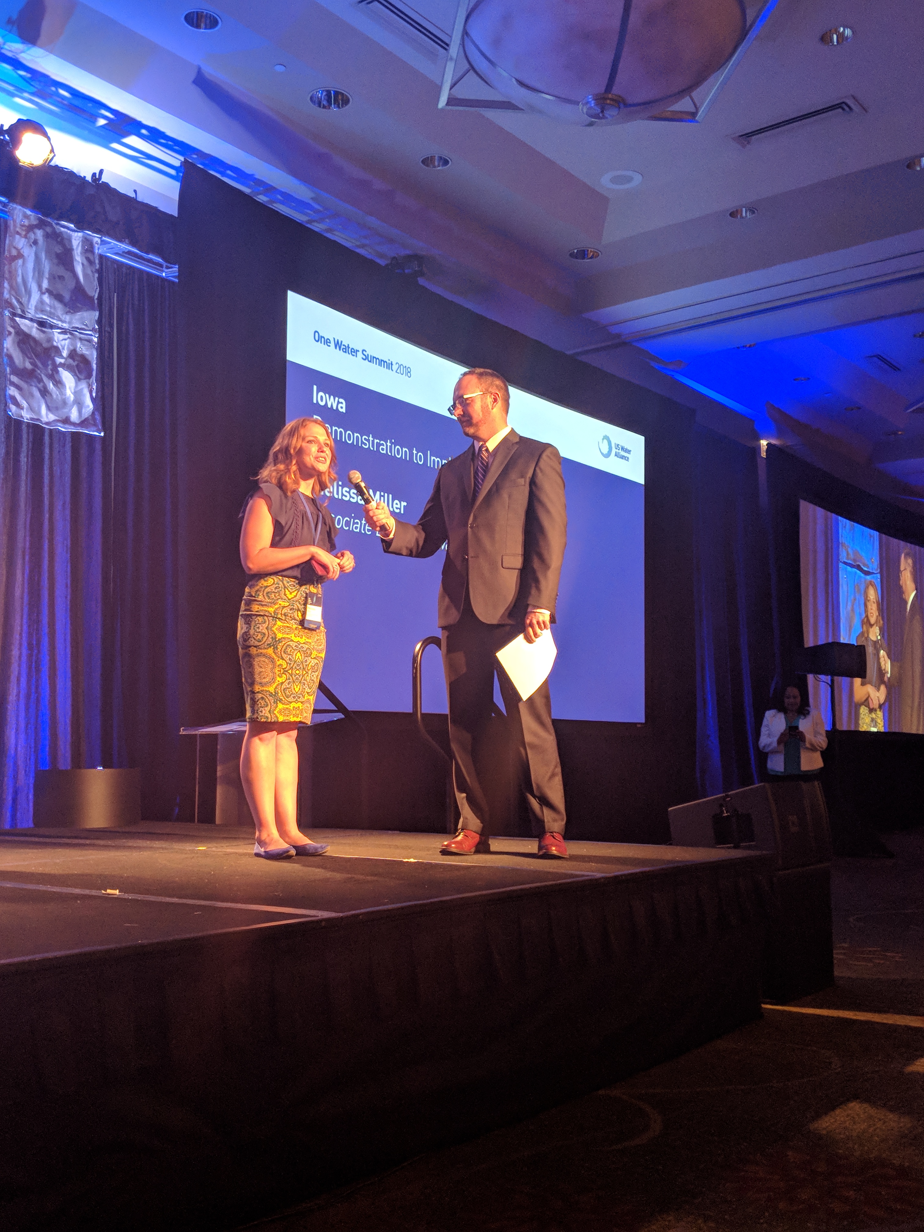
Miller presented Iowa’s commitment to water during closing remarks at the 2018 One Water Summit. Iowa had a conference delegation of over 50 people representing agencies, non-profits, and educational institutions who make an impact on water.
“Water connects us all. This core belief drives our work in Iowa, one we’ve seen in action over the last five years and one we focus on in the year to come. We celebrate the fifth year of the Iowa Nutrient Reduction Strategy, strengthened by the $97 million Iowa Watershed Approach to reduce flooding and improve water quality, as well as the Conservation Infrastructure action plan that brings together public and private sector partners to scale up those practices recommended by the science-based strategy. This next year, we commit to significant progress towards healthier watersheds as measured by conservation practices on the ground.”
-Melissa Miller, Associate Director of the Iowa Water Center
Why I am Getting into Soil and Water
Post submitted by Lindsay Brown, recent graduate from Iowa State University and member of Iowa State’s Soil and Water Conservation Club (SWCC)
My name is Lindsay Brown and I have recently graduated Iowa State University with a Bachelor of Science Degree in Biology and Environmental Science. I joined the Soil and Water Conservation Club (SWCC) in the fall semester of 2016 and it has provided me with vast amounts of knowledge surrounding the topic of soil and water conservation. Over the years I have heard many presentations from graduate students, professors and other professionals working in the field. The presentations range from land management and conservation to farming practices. Hearing from these various professionals has allowed me to diversify my knowledge about these topics and develop a better understanding on how conservation efforts can be implemented and managed. The SWCC does not only meet every other week and listen to presentations, but we also sell, assemble and present Groundwater Flow Models. These models visually represent how water moves throughout the ground. This visualization can help students, farmers, faculty, or really anyone to realize the importance of water movement on the surface and underground and how understanding its movement can lead to specific water management practices. The Groundwater Flow Models are sold and distributed nationally and internationally and the profits go toward club funds, which allows us to go on trips and attend conferences for professional experience.
The SWCC also has an annual publication called Getting into Soil and Water that is put together by the publication committee. Getting into Soil and Water is a publication that is composed of a variety of articles related to soil and water about local and international subjects written by professionals from various backgrounds. I have been an editor for this publication since August of 2016 and have learned a lot about the editing process, leadership skills, and how to communicate efficiently and effectively with my peers, authors and sponsors. At the beginning of the year, the publication committee discusses and brainstorms different possibilities for themes the publication could follow. After the theme is discussed and we’ve reached a consensus, authors are then contacted to see if they would like to write an article in the publication. After all the articles are retrieved, the editing process begins. Each article is edited many times by each member of the committee and compiled into a cohesive publication. Once the publications are printed, they are distributed to people all around the state of Iowa. Through my experience of being an editor, I learned how to delegate effectively and to recognize the value each person brings to a team in achieving a larger goal. Being an editor also gave me experience running meetings, helped me to develop confidence voicing my opinions in a group setting and allowed me to share ideas with my peers in the publication committee. All of these experiences will be useful for my future career goals and aspirations.
Since graduation I have moved to Minneapolis and now have an internship with the University of Minnesota partnered with the City of Woodbury leading a water conservation project. My future career goals are to work with environmental consulting to decrease environmental degradation and improve the health of communities and ecosystems. Being a part of the SWCC and the Getting into Soil and Water publication committee as an editor, has provided me with multiple years of experience learning about conservation practices as well as practical communication skills. I would definitely recommend students to get involved in student organizations like the SWCC on campus, because it provides you with lifelong practical skills for your future career.
Lindsay Brown is leading a water conservation project with the Minnesota Technical Assistance Program in Minneapolis, Minnesota. She has a B.S. in Biology and Environmental Science from Iowa State University. She is currently looking for full-time employment doing environmental consulting in the Twin Cities area.
2018 Iowa Water Conference (Photo Recap)


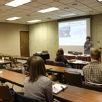

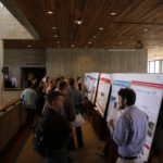


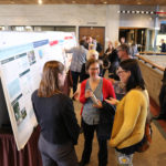
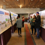


Photos from the 2018 Iowa Water Conference. Photos by Hanna Bates, Program Coordinator at the Iowa Water Center.