Iowa Water Center Visit Up North

Post written by Melissa Miller, Associate Director for the Iowa Water Center

IMG_E6094[1]

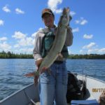
One of the greatest benefits of being part of the National Institutes for Water Resources is the connection to the other 53 Water Resources Research Institutes across the country – including those in surrounding states. Last week, Iowa Water Center staff took a day trip up to the St. Paul campus of the University of Minnesota to visit the Minnesota Water Resources Center (MWRC) staff.

We had a full agenda for the day, well-planned by Iowa State University alum Adam Wilke, who serves as the MWRC Research and Outreach Coordinator.

After a quick tour of the campus with our colleagues MWRC Director Jeff Peterson and Associate Director Joel Larson, we visited with MWRC’s Ann Lewandowski and Matt Drewitz from the Minnesota Board of Soil and Water Resources on the best outreach and communication methods for the Daily Erosion Project (coverage for the entire state of Minnesota coming very soon!).

Next, Leif Olmanson from UMN’s Remote Sensing and Geospatial Analysis Laboratory and Ben Page from MWRC introduced us to remotely sensed water quality monitoring in Minnesota lakes with their tool, LakeBrowser.  This technology is helping Minnesotans keep an eye on water clarity, chlorophyll, suspended solids, and colored dissolved organic matter on all lakes in the state over 10 acres. LakeBrowser covers some lakes in Iowa and can be expanded outside the borders of Minnesota.

We enjoyed lunch with the entire MWRC crew. Afterward, we joined in a planning call for the University Council of Water Resources annual conference, to be held in Minneapolis June 9-11. The theme for the 2020 UCOWR Annual Conference is “Water. Place. People.” The call for special sessions is now open – this is a great conference for university researchers and students, and we encourage you to submit a session idea.
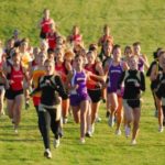
IMG_6100[1]To round out the day, we headed over to the banks of the Mississippi River to chat with Pat Nunnally from UMN’s River Life program. We talked about the history of the Mississippi and River Life’s interdisciplinary journal Open Rivers, which features fascinating pieces that explore topics on water, place, and community. We also got to witness Pat in action, as a mudslide on the banks that morning brought television news crews to the scene, wondering how and why these things occur (Pat makes an appearance around 1:35). Thankfully, we managed to avoid any cameos in the news story!
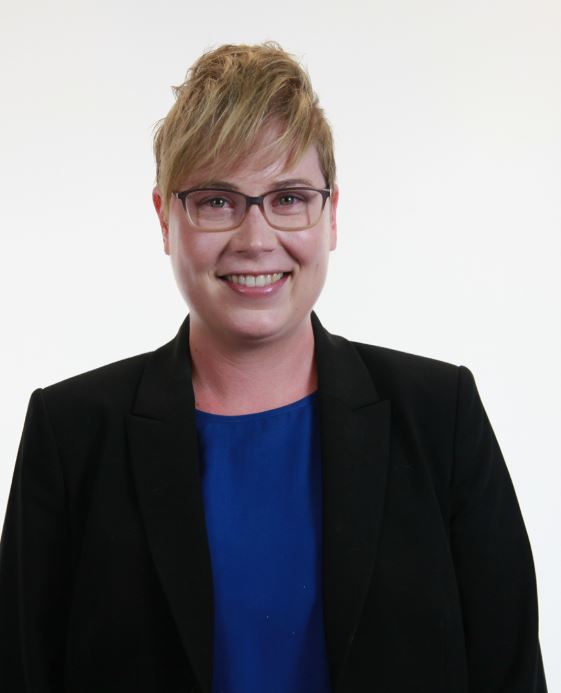
IMG_6098[1]We want to sincerely thank the entire UMN staff for their hospitality. We came away with actionable items to increase our collaboration between the two centers and throughout the region, as well as some great ideas we might borrow from UMN to incorporate here in Iowa and at IWC. We look forward to their visit to Iowa next spring!


Melissa headshot_0Melissa Miller is the associate director of the Iowa Water Center. She holds a BS in Kinesiology with an emphasis in Community and Public Health and MS degree in Community Development with an emphasis in Natural Resource Management, both from Iowa State University.


University of Iowa: A case study of flood response


In honor of construction starting soon to replace one of the last University of Iowa buildings damaged by the 2008 floods, we have decided to highlight a history of flood infrastructure investments at the university .

Just one-year shy of a decade since the 2008 floods, the final plans have been approved for a new facility for the University of Iowa Museum of Art. Like Hancher Auditorium, the music school, the library, and the Iowa Memorial Union, among about seventeen other buildings (Connerly et al 2017), the art museum was a significant loss to the university that scattered its 14,000-estimated piece collection to new locations on and off campus.

According to Connerly et al 2017, damages and recovery were estimated to be $743 million and is the highest costing disaster recovery in Iowa. As a public institution located in a floodplain area, it has had a history of flood preparation and response since its inception in 1847. As their article explains, the flooding brought up many critical questions, including: “why did the University construct important new buildings, some of them iconic, within the floodplain?” and how can the university cope with future natural and human-made flooding?

To answer the first question, the university built where they did predominantly because they had few options. The risk of flood also gave the appearance of being manageable at the time and policies for flood mitigation and subsidies were more risky than they appeared to be (Connerly et al 2017). The university started on a small four block area east of the Iowa River. The university and the City of Iowa City grew concurrently causing buildings to be placed closer and closer to the river. In 1905, the university commissioned a master plan by the Olmsted Brothers that included riverfront property, but its use would only be for recreation and parks (Connerly et al 2017). Land acquisition advisement by the Olmsteds was illustrated in the following:

“The Olmsted Brothers emphasized the need to acquire land that would be of value to the University, even if it costs more. They stated, ‘‘the process of acquisition of additional land must evidently go on indefinitely, but some other motives than those of convenience and cheapness should be kept in mind and should often have more weight than those.” (55)

The construction on the floodplain started with the Iowa Memorial Union (IMU) in the 1920s and then grew to include the arts campus. Construction for a fine arts building was originally planned for a site north of the IMU, but an agreement could not be reached for a price. Instead, the campus was developed on acquired land that was a wetland formerly used as a city landfill by the river (Connerly et al 2017).

The wetlands were filled and the buildings were constructed to be above recorded flood level data available at the time and levees were constructed on the river. Later, these efforts included the university’s support of building the Coralville Reservoir by the Army Corps of Engineers, in which the president of the university at that time stated, “the Reservoir will make possible a program for the permanent development of the river front through the University campus” ( Connerly et al 2017, p.58). The campus was growing in two halves on the east and west side of the river. Development in-between would unite the two pieces, especially when considering there were little other places to build.

This culminates in the issue of what Connerly et al (2017) describes as the “safe development paradox.” This term is used to describe the federal support for levees, dams, disaster aid programs, and other assistance that spurred development in the floodplains. By providing a safety net with federal assisted water-related control, recovery, and insurance, federal policy enabled development that came at a cost with the 1993 and 2008 floods.

How can the university cope with natural and human-made flooding for the future?

To answer this question, the university has responded to the 2008 floods by re-purposing or completely rebuilding new facilities that are more resilient to withstanding future flooding using scientific modelling as a tool. The recovery efforts include a multitude of partnerships that choreograph their work around where FEMA compliance and insurance policies reach within each building. The university voluntarily chose to conduct a campus-wide flood mitigation strategy that is in progress. This strategy includes elevated sidewalks, supports for temporary flood walls, building pumping systems, and removable external walls. The university has also rebuilt two buildings away from their original locations. As seen above, these strategies have been tested with the rise in water levels in 2013.

In review, the tumultuous history of flooding infrastructure contains valuable lessons. Resilience, which is at the core of what public infrastructure is trying to achieve, is the ability to spring back from disasters. The university that came out on the other side of the 2008 floods is one that utilizes water research and technology using scientific methods and demonstrates that there is room for improvement in state and federal policies and procedures. As a result, when future flooding occurs, we will all be better able to respond.

Connerly, Charles, Laurian, Lucie, Throgmorton, James. 2017. Planning for Floods at the University of Iowa. Journal of Planning History 16(1): 50-73.

Capture
Hanna Bates is the Program Assistant at the Iowa Water Center. She has a MS in Sociology and Sustainable Agriculture from Iowa State University. She is also an alumna of the University of Iowa for her undergraduate degree. 

Caring for Creation & Sister Water

Caring for Sister Water was one of many creation care efforts that came with the founding of Prairiewoods 20 years ago. These efforts included two infiltration ponds that hold much of the water that runs off our parking lots and roadways, as well as numerous trees and plants with extensive root systems that hold and cleanse water. After the Cedar Rapids floods of 2008, we doubled our efforts to address storm water concerns— we installed permeable pavers, hosted rain barrel classes and identified four storm water culverts that drain on our land. Varying degrees of erosion meant that all four of these culvert areas needed attention.

Continue reading

Planning for Watershed Success in Eastern Iowa

11108858_986702184682588_7720700685004655431_n
Attendees of the Indian Creek Watershed open house discussing the map of the watershed. Photo from the Indian Creek Watershed Facebook page.

Post edited by Hanna Bates, Program Assistant at the Iowa Water Center

This week, we chatted with Jennifer Fencl, the Solid Waste & Environmental Services Director at The East Central Iowa Council of Governments (ECICOG). Fencl works to bring eastern Iowa stakeholders together to better manage their natural resources and to create a long-term investment in their community. Below are a few highlights from our conversation that outlines some of the behind-the-scenes work in watershed planning.

Please describe your work in watershed management in Iowa.

The East Central Iowa Council of Governments (ECICOG) became involved in watershed management in 2011 when the City of Marion requested assistance in applying for Watershed Management Authority Formation grant funding from the Iowa Economic Development Authority (IEDA) for the Indian Creek watershed. The Indian Creek Watershed Management Authority (ICWMA) was formed under Iowa Code 28E and 466B in August 2012 with 6 of the 7 eligible jurisdictions agreeing to plan for improvements on a watershed level. Funds were made available in 2013 by the IEDA to complete watershed management plans to address flood risk mitigation and water quality. The ICWMA received one of the three planning grants and engaged in a multi-jurisdictional planning approach facilitated by ECICOG in partnership with several local, state, and federal agencies. The resulting Indian Creek Watershed Management Plan (ICWM Plan) identifies strategies and recommendations for stormwater management and water quality protection, including specific implementation activities and milestones. The ICWM Plan was completed and presented to the public in June 2015 and adopted by all six of the ICWMA members at policy maker meetings during July and August of 2015.

As the ICWMA Plan was wrapping up, the City of Coralville requested ECICOG’s assistance in forming a WMA for the Clear Creek watershed. In this case, Coralville was willing to sponsor the WMA formation and planning grant application services. The Clear Creek Watershed Coalition (CCWC) formed as a WMA under Iowa Code 28E and 466B in October 2015 with all 9 of the eligible jurisdictions joining. ECICOG secured DNR watershed planning funds early in 2016 and the CCWC is mid-way through their planning process. Fortunately, the Clear Creek watershed was one of the eight watersheds selected for the Iowa Watershed Approach HUD grant project. The additional watershed planning funds from the HUD grant will add significantly to the resulting watershed plan.

In early 2016, the Middle Cedar Watershed Management Authority (MCWMA) was on its way to formally becoming a WMA and needed some help in completing the agreement filing, developing by-laws, and organizing the Board of Directors. ECICOG assisted the MCWMA in forming under Iowa Code 28E and 466B in June 2016 with 25 of the 65 eligible jurisdictions joining. The MCWMA is one of the eight watersheds selected for the Iowa Watershed Approach HUD grant project.

What are the challenges and rewards in doing work with watershed management?

One challenge that became clear in the Indian Creek process was the disconnect between the watershed (technical) assessment and the local stakeholders. That gap must be bridged to develop meaningful, locally-based goals and implementation strategies.  For me, the reward is watching the interaction between perceived “enemies” (urban/rural; big city/suburb; ag producer/government type) and bringing skeptical people into the process to develop an actual plan… that they ultimately agree to.

What kinds of stakeholders are involved in developing a watershed management plan?

It is critical to include the local Soil and Water Conservation District, government representatives, and the landowners (both urban & rural, flood impacted if possible) in developing goals and strategies. I believe that it is also important to identify the ‘experts’ in your watershed, both locally and from state agencies, early on and have them provide input on what assessment activities and planning services are really needed from an outside consultant. There is a role for everyone to play.

What are the basic steps in putting together a watershed management plan?

Here is my road map:

  1. Invite participation
  2. Identify resource concerns
  3. Assemble experts
  4. Complete assessment work
  5. Present the assessment to a broad list of stakeholders (need good interpreters)
  6. Develop goals, define implementation strategies, and prioritize the strategies
  7. Compile the plan and present the plan for comment
  8. Shop the plan for formal adoption by policy making board/councils.

What is one piece of advice you’d give to those wanting to develop a watershed plan for their community?

Run… kidding, sorta.  Seek help from the Iowa Department of Natural Resources and Iowa Department of Agriculture and Land Stewardship basin coordinators first, and then gauge the interest of the other entities in the watershed. You need to find some champions to help smooth the way for local elected officials.

People are asking about the 2017 Iowa Water Conference…

… and we have answers!

Written by Melissa Miller, Associate Director of the Iowa Water Center

It’s that time of year again. Everywhere I go, I get questions about the Iowa Water Conference. Here are a few of the recurring questions:

What’s the theme this year?

Watershed Management: Partnerships for Progress

 Is the agenda filled up?

You bet – chock full. We’re going to release it as soon as we’ve fine-tuned the last few details.

 Can I still submit abstracts?

We do have ONE track that we’ve left unfilled on purpose. The Current Research track will have an open call this January. We plan for this track to have nine 30-minute spots available. Keep an eye open for that call – it won’t last very long, as we’ve had a lot of interest! If you don’t get selected, we certainly encourage you to submit a poster.

And my favorite question to answer: What’s new for 2017?

 Last year is going to be hard to top, but we’re trying. The conference committee carefully considers your comments and evaluations each year and makes little tweaks here and there. Some highlights from 2017 to look forward to:

-The addition of the Iowa Chapter of the American Fisheries Society to the conference. We have several fisheries related talks that will appear in the main conference program, as well as a special track that will serve as their regular spring conference.

-Bringing back the evening reception. We will host a networking social hour on Wednesday evening in Scheman featuring an exhibit titled, “River Stories: Views from a Watershed.” This is a photo exhibit detailing stories created by women farmland owners in the Raccoon and Des Moines River valleys.

-A time for panel presentations. To cap off the first day breakout sessions, we will have a full hour for four concurrent panel presentations to encourage discussion and collaborative thinking.

-Optional workshop: Prairie STRIPS. The STRIPS team is working on developing a two-hour workshop on implementing this beautiful and effective water management practice.

Spirit of the Water Essay Contest. With thanks to a generous donor, the Iowa Water Center is holding a writing contest for students in the state of Iowa in high school, college, or graduate school. Entries are being accepted through February 1; visit our website for more details.

This is all in addition to the perennial block of excellent plenaries, breakouts, award presentations, photo contest, networking, Scheman sticky buns, posters, exhibitors, and more! Look for the full agenda to be released next week and registration to open in January (we’ll announce the date on social media and email our subscribers).

Get to know the Prairie STRIPS Project

Two weeks ago, the Iowa Water Center staff attended a lecture on a study conducted with the Iowa State University Prairie STRIPS Project. Eduardo Luquin Oroz, graduate student at the University of Wageningen, presented results from examining the sediment deposition at the sites associated with this project as well as the strip width effects on sediment deposition. After leaving the presentation, the above quote immediately entered my mind.

Continue reading

Get to know the Daily Erosion Project

Answering a speaking request from the Nebraska Natural Resource Districts, I delivered a talk last week in Central Nebraska. Kearney, Nebraska to be more exact. Kearney is located deep into the irrigated area of the Great Plains, and so I wondered a little – actually more than a little – why this group would be interested in my focus area of soil erosion. More specifically, why they would be interested in hearing about our Iowa State University project called, The Daily Erosion Project.

Continue reading