Modern corn culture came to Iowa with the settlers that moved across the United States. Farmers, hopscotching westward to Indiana, Illinois and Iowa from the valleys of Ohio, Kentucky, and Tennessee, brought the agriculture of the Upland South with them- Dent corn and hogs.
Continue readingTechnology for Soil and Water Conservation Practices
Soil and water conservation has long been recognized as a critical need for Iowa, the country, and the world. Two of the most important soil and water conservation ‘tools’ are terraces and grass waterways.
Continue readingHuman-induced Soil Change in Iowa: Two Contrasting Examples
The crops of Iowa yielded 100’s of trillion of calories in 2012. Those calories are feeding 100’s of millions of chickens, pigs, cattle and other livestock. They also help fuel millions of vehicles.
Continue readingWhat Soils are Made of and How They Develop
Soil is defined as media that supports plant growth and plant development. A soil consists of solids and spaces between the solids (voids). The solids include inorganic and organic materials. Inorganic materials include minerals such as quartz, feldspars, and mica.
Continue readingAsk a Scientist – Healthy Soils
We ask Marshall McDaniel, Assistant Professor in Agronomy at Iowa State University, the question: What does healthy soil look like?
Continue readingBridging the Divide in Water Resource Management
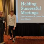
Written by Hanna Bates, Program Coordinator for the Iowa Water Center
Regardless of who you are and what path you are on; we all make an impact on water. This belief was the overarching theme of the 74th Soil and Water Conservation Society International Annual Conference held July 28-31 in Pittsburgh, Pennsylvania.
This city, at the confluence of three rivers and contains 446 bridges, is a town of connections that bridges one side of a river to another. This set the scene for the conference in which diverse ideas were brought together to represent our anthropogenic impact on water resources. Conference attendees included those from private industry, public institutions, and government agencies. The three days of presentations, symposia, and tours enabled attendees to debate ideas and address critical questions about the future of our soil and water resources.
Iowa water resource professionals were well represented on the agenda and covered a vast array of topics. These topics included outreach, education, and community engagement; conservation models, tools, and technologies; professional development; engaging the private sector; water resource assessment and management; and social sciences informing conservation.
On the third day of the conference, I attended a tour on how the City of Pittsburgh alongside several other organizations are restoring impacted landscapes within the city and in nearby rural areas. For several decades, the coal and natural gas extraction industries and steel mills had a negative impact on the surrounding landscape due to the establishment of mine drainage areas and dump areas for slag, a waste product from steel production. Tour stops showcased areas that are in the process of being restored.
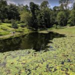
One stop of the tour was the Pittsburgh Botanic Garden, which is an outdoor garden that spans approximately 450 acres of land. Opened in 2015, this is a long-term program to reintroduce native plant species. During a one-year span in 2015, the garden staff planted 9,000 flowering bulbs and 1,500 saplings. Each year, thousands more are planted. The goal is not only to restore the landscape, but also to provide a place for outdoor education and enjoyment of nature. On the day we visited, approximately 40 acres of the 450 acres were rehabilitated and open for the public to visit.
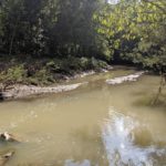
Another stop on the tour was at Pittsburg’s Frick Park and the 9-Mile Run Watershed. This 6.5-square mile watershed flows through the park and carries on to a slag dump site that was in operation from 1922-1972. Restoration projects in collaboration with the City of Pittsburgh and the 9-Mile Run Watershed Association have improved the site to make it the beautiful walking trail and recreational area that it is today. The area is located near vulnerable communities in Pittsburgh, and so it was restored with the belief that everyone deserves access to nature because of the positive impacts it can have on health and well being.
The Soil and Water Conservation Society along with the Pennsylvania Chapter of SWCS did an excellent job fostering conversations among meeting attendees as well as highlighting the natural resource challenges and solutions in the Pittsburgh area. Next year the 2020 SWCS Conference will be celebrating its 75th year in Des Moines, Iowa.
Save the date for July 26-29, 2020 so that you can be a part of the celebration!
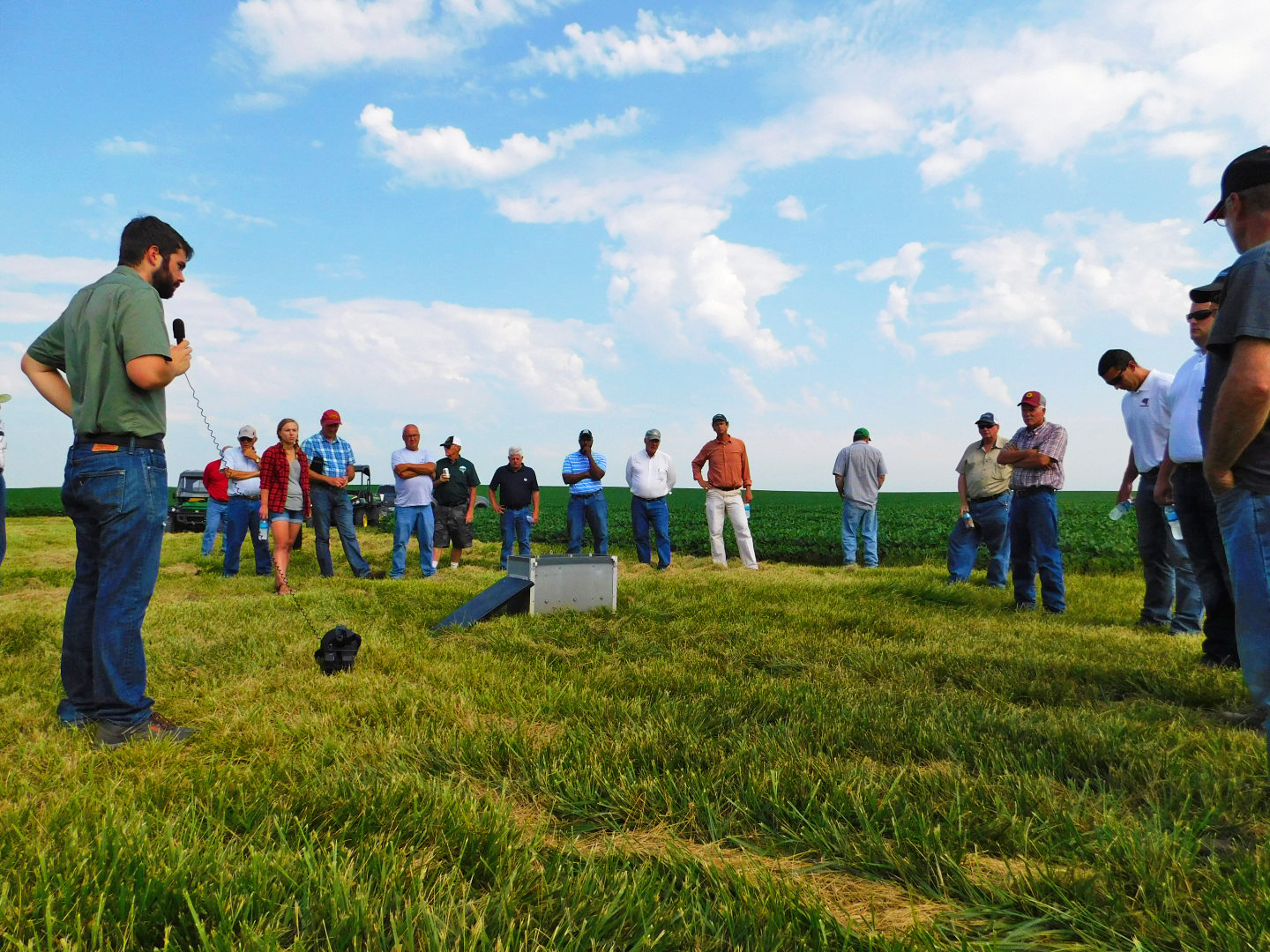
Establishing a Culture of Conservation with Prairie STRIPS
Written by Hanna Bates, Program Coordinator for the Iowa Water Center
Across the Midwest, farm fields are patterned with commodity crops, including corn and soybeans. Although supportive of our global economy, this agricultural system is a leaky one with shallow roots systems in the field that leaches nutrients and depletes the soil. In Iowa’s history, landscapes were previously protected in a blanket of prairie that would build deep roots and replenish the soil. Commodity production and conservation are not necessarily mutually exclusive choices, but an integrative system that farmers can establish on their farms.
Prairie STRIPS is a process in which farmers plant approximately 10% of prairie on the contour while growing their regular rotation in the rest of the field. Over the last 8 months, I have been working with a farmer in Hardin County to establish STRIPS on his 128-acre farm field. Planning STRIPS is an iterative process between the conservation planner and the farmer so that it fits his/her needs. In what I have learned in putting in prairie STRIPS, there is nothing cookie-cutter about the process. Rather, it is one that requires visits to the field and detailed conversations so that the farmer can reach the goals s/he sets for the land.
Visiting the field
Before we can start putting a plan on paper, it is important to go out and walk the field with the farmer to see what the topography is like and how the drainage flows through the field. In walking through this field, I saw that the farmer had grassed waterways already established. Despite having a few practices like this in place already, there were a few spots in the field that were experiencing a wash out every growing season and were financial losses. These happen to be primary spots where Prairie STRIPS could be placed. When this was noted to the farmer, he was excited for the possibilities of how his field could perform in yields by saving these spots and preventing problems, such as soil deposits and increased drainage velocity for the areas below the washout spots in his field.
Making the plan
After visiting the field, the next step is to work in ArcMap to sketch out where the potential STRIPS can be placed. Using a series of maps and knowing the future rotations plans in the field aids in this decision-making process. These aren’t necessarily viewed as limitations, but rather as narrowing the scope and providing direction to planning in ArcMap. We started with integrating the contoured STRIPS with the grassed waterways as well as adding blocked STRIPS at the south end of the field. We presented the plan to the farmer and the few edits we had to make to the plan were to square off where the Prairie STRIPS meet the grassed waterways for ease of mobility for his equipment. All strips were placed at intervals that are divisible by 30-feet to accommodate equipment and create uniform farming lanes. Prairie species included in the STRIPS is a mix of grasses and forbs (see Table 1 below). Maintenance will require routine mowing.
Identifying future needs
The Prairie STRIPS are currently in the first year of growth as they were planted in late Spring 2018. The first several years require some maintenance with mowing, but as the species grow and mature over time, they will require less maintenance. As these plants mature, they will provide a wildlife habitat and serve as a corridor for migrating birds. The STRIPS will provide ecosystem benefits as well as serve the community up in Hardin County by being a model for conservation and set an example for others in respect to what good farming is.
In Summer 2019, we will hold a Prairie STRIPS field day on the farm. Be sure to sign up for our newsletter to receive the details!
| Table 1. Prairie STRIPS Prairie Species | |
| Grasses | Forbs |
| Big Bluestem | Anise Hyssop |
| Sideoats Grama | Common Milkweed |
| Prairie Brome | Smooth Blue Aster |
| Canada Wild Rye | New England Aster |
| Switchgrass | Canada Milk Vetch |
| Little Bluestem | White Wild Indigo |
| Indiangrass | Partridge Pea |
| Prairie Dropseed | Tall Coreopsis |
| White Prairie Clover | |
| Purple Prairie Clover | |
| Showy Tick Trefoil | |
| Purple Coneflower | |
| Rattlesnake Master | |
| Ox-eye Sunflower | |
| Meadow Blazingstar | |
| Prairie Blazingstar | |
| Wild Bergamot | |
| Wild Quinine | |
| Foxglove Beardtongue | |
| Yellow Coneflower | |
| Black-eyed Susan | |
| Compass Plant | |
| Stiff Goldenrod | |
| Purple Meadow Rue | |
| Blue Vervain | |
| Culver’s Root | |
| Golden Alexanders | |
Reviewed by the STRIPS science team at Iowa State University for science/economic content related to prairie strips on September, 7, 2018.
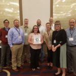
Forming Successful Partnerships: Connecting Water Quality and Communities for the Benefit of All
Post submitted by Josh Balk, Dry Run Creek Watershed Improvement Project Coordinator, and Shane Wulf, Miller Creek Water Quality Improvement Project Coordinator.
In an ever-changing environmental landscape with increasing demands, tighter budgets, and a sense of uncertainty, partnerships are essential to provide resiliency for any water quality effort. Whether a watershed project, a community organization, or just an enthusiastic individual, creating collaborative initiatives can provide support to help weather any storm. Although requiring an initial investment on the front end to get set up, the long-term benefits of having partners to rely on and bring resources to the table should be justifiable. Identifying partners is indeed the first task, which can be daunting in itself. Every community is different and being able to recognize the local resources available is a skill. Once identified, nurturing these relationships to continue being successful is even more important. Ensuring that there is some form of mutually beneficial exchange will help all parties feel active, engaged, and remain involved. Whether it’s looking for matching funds, education and outreach, volunteers, or expanding support, partnerships can add a lot of value in to initiatives. Getting creative with partnered projects can help to hit untapped audiences and help an initiative stand out in the crowd.
The Black Hawk Soil and Water Conservation District has two watershed projects coming at water quality improvement efforts from different angles. This has included recognizing the local concerns and utilizing the resources available to each of their benefit. The Miller Creek Water Quality Improvement Project has formed many successful partnerships working with regional, state, and federal agencies as well as commodity groups. Two prime examples include the Middle Cedar Partnership and Midwest Agriculture Water Quality Partnership RCPP projects. These projects include several partners spanning from the City of Cedar Rapids, the Sand County Foundation, the Iowa Department of Agriculture, and many others. Together, these projects provide federal funding for conservation efforts in addition to Miller Creek WQI practice dollars. In 2017, the Miller Creek Project experienced high cost-share demand resulting in a $27,000 practice deficit. In response to this demand, Black Hawk SWCD and Iowa Agriculture Water Alliance (IAWA) formed the Miller Creek Challenge. Providing a $13,500 grant, IAWA challenged the Black Hawk SWCD to raise the remaining funds. With anticipation of a repeat experience, the Black Hawk SWCD increased their goal to raising $100,000 and are currently fundraising with private citizens, businesses and many organizations. These efforts have helped Miller Creek to bring in many additional funds to help improve water quality.
On the other end of the spectrum, the Dry Run Creek watershed is about 44% urban with a large residential population of Cedar Falls having a direct impact on the stream. The Dry Run Creek Watershed Improvement Project has focused a large effort towards partnerships involving the local educational systems to find enthusiastic volunteers passionate about water quality. This has involved students in kindergartners all the way up to seniors in college. Efforts have included rain garden installations, conservation book publishing, stream assessments, water monitoring efforts, outreach events, and educational materials just to name a few. These have all helped Dry Run Creek to succeed in its goals while also drumming up community awareness and support, two essential features for any watershed project.
Given the theme for this year’s Water Conference, ‘Our Watershed, Our Community’, the goal of this presentation will provide valuable insight in to the connection between the two. We are very excited for this opportunity to share our successes so that others may expand upon their networks for the benefit of water quality in Iowa.
Josh Balk has been the Dry Run Creek Watershed Improvement Project Coordinator for three years. He received his B.A. in Earth Science from the University of Northern Iowa.
Shane Wulf has been the Miller Creek Water Quality Improvement Project Coordinator for 4 years. He received his B.S. in Geography with a Geology Emphasis from the University of Wisconsin-Whitewater.
Measuring Progress of the Iowa Nutrient Reduction Strategy: The 2017 Annual Progress Report
Written by Laurie Nowatzke, Measurement Coordinator for the Iowa Nutrient Reduction Strategy, College of Agriculture & Life Sciences at Iowa State University
This week, the 2017 Annual Progress Report for the Iowa Nutrient Reduction Strategy was published. The report is the fourth annual progress evaluation of the NRS, and represents the continued improvement in communicating Iowa’s steps towards its goal of reducing annual nitrogen and phosphorus loss by 45%. For the first time, a summary infographic has been developed to pare down the in-depth report to its highlights.
Organizations across Iowa—public agencies, private entities, NGOs, and universities—form vital partnerships and have taken strides in the work toward meeting NRS goals.
- Funding for NRS efforts totaled $420 million in 2017, an increase of $32 million from the previous year.
- Annual outreach events reported by partner organizations effectively doubled in the last year, reaching 54,500 attendees in 2017.
- Wastewater treatment plants and industrial facilities continue to make commitments to improve their nutrient removal processes. Of the 151 facilities required by the NRS, 105 have received new permits; of those, 51 have submitted feasibility studies on potential technology improvements.
These increased efforts represent early inputs into the Strategy, allowing work to ramp up and begin influencing tangible change in the state.
Increased funding and outreach, along with the continued dedication of other inputs by partner organizations, are having an impact on the Iowa landscape.
- Cover crop acres have increased drastically, from just 15,000 estimated acres in 2011 to more than 600,000 acres in 2016.
- During that 2011-2016 time period, 36 nitrogen removal wetlands were constructed, treating 42,000 acres.
- Also since 2011, a net increase of 155,000 row crop acres have been retired under the Conservation Reserve Program, with total CRP land retirement nearing 1.7 million acres.
At this point, the extent of conservation practices in Iowa pales in comparison to what is likely needed to meet NRS goals. However, these steps forward represent very early change resulting from statewide NRS efforts.
The water quality impacts of these efforts will continue to be assessed. At least 88% of Iowa’s land drains to a location with a nitrate sensor, allowing researchers to evaluate Iowa’s annual nitrogen loss and detect potential changes in the nitrogen load reaching the Mississippi River. Ongoing research aims to provide similar estimates of annual phosphorus loads beginning in 2018. In addition, using models developed for the NRS Science Assessment, the Annual Progress Report provides an annual estimate of the nutrient reductions affected by the conservation practices installed across the state.
The Annual Progress Report, and other NRS documents, can be found at www.nutrientstrategy.iastate.edu.
 Laurie Nowatzke is the Measurement Coordinator for the Iowa Nutrient Reduction Strategy, in Iowa State University’s College of Agriculture & Life Sciences. She has a MA in International Relations & Environmental Policy from Boston University, and a BS from Wright State University. She is currently pursuing a PhD in Sociology at Iowa State University.
Project-Based Learning for future water leaders
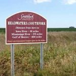
Student project from the Bluestem Institute (left). Image of the Southfork Watershed Alliance sign (right).
Story submitted by Melissa Miller, Associate Director for the Iowa Water Center
In fall of 2015, I met with a group of 60 high school students at the headwaters of the South Fork of the Iowa River, right off the shoulder of Hwy 69 in North Central Iowa. It was a beautiful (but cold) fall morning, and I wasn’t sure what to expect. All I knew was that a class from Ames High School (AHS) was out to define a list of water quality terms, and they were doing so through experiences, including this on-site interview with my local farmer-led grassroots watershed group.
What I found out about this group of students was worth my shivering out in the cold while corn-loaded semis blasted by the school buses at 60 mph. These students and three teachers were part of the Bluestem Institute, an integrated capstone seminar based on project-based learning and extended inquiry frameworks. As I built a relationship over the next several months with teachers Mike Todd, Joe Brekke, and Chad Zmolek, we discovered more ways for the class and the Iowa Water Center to interact, culminating in a gallery showing of the students’ final projects at the 10th annual Iowa Water Conference.
I wasn’t the only one transfixed with the students’ high level of engagement and understanding of complex water issues. Pat Sauer, with the Iowa Stormwater Education Partnership, came to me in early summer of 2016 with a vision of packaging the Bluestem Institute and making it accessible for all schools in Iowa to implement.
Serendipitously, the Leopold Center for Sustainable Agriculture had recently received a bequest from the estate of Iowan Robert Margroff designated for youth education about the environment. With the help of the AHS teachers that created the Bluestem Institute, we submitted and were subsequently awarded three years of funding to develop the framework and pilot it in two Iowa schools.
Now nearly a year into the project, dubbed “The Watershed Project,” we have discovered that we are always learning. Davenport North High School faculty Laura McCreery and City of Davenport Public Works employee Robbin Dunn are nine weeks into implementing the project in McCreery’s classroom. Over the life of the project, we will blog about the process of designing the framework and the experiences of our implementation schools.
The immediate outcome of this project will be an educational framework for teachers to implement project-based learning in Iowa high schools that address intersections of science, government, sociology, economics, and art as they relate to decision-making regarding water and land use at local levels. We hope to inspire more than that – we hope this program inspires students and communities to take greater interest in environmental sustainability issues. We hope the students in these programs consider entering STEM fields post-graduation, armed with interdisciplinary knowledge so they can inspire new solutions. We hope to develop emerging generations of citizens and civic leaders that value and implement environmentally sustainable policies and strategies. Ultimately, we dream of engaged, resilient communities that proactively and collaboratively address soil and water conservation issues.