Everyone’s heard that April showers bring May flowers. But, more accurately, April showers bring loss of the environment’s powers. These springtime showers create significant water runoff from rural and urban landscapes, runoff that can contain fertilizer, oil, pesticides, dirt, bacteria and other pollutants. This process leads to soil and nutrient loss as the water travels over land and into bodies of water.
The Daily Erosion Project works to estimate the amount of water runoff from the sloping hills of Iowa and the surrounding states. This project (hereby referred to as DEP) also estimates the severity of the soil erosion that occurs as a result of precipitation events. These estimates are taken based on hill slope conditions (e.g. shape/texture of land, crops present, amount of precipitation) that are identified by remote sensing tools, such as satellites.
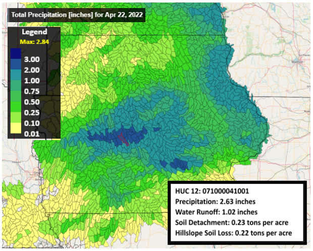
An interactive map on the DEP website allows users to select a watershed and receive data on precipitation, water run-off, soil detachment, and hill slope soil loss. This year’s Earth Day saw heavy rain in the central Iowa area. The image above shows an example of HUC12 watersheds, which are the sub watersheds of USGS’s Watershed Boundary Dataset and can be found in the DEP database. The HUC12 selected (which is the red outline on the map) shows estimations based on the WEPP (Water Erosion Prediction Project) model for April 22, 2022.